An aerial view of downtown Lorain, Ohio and the Black River c. 1950s
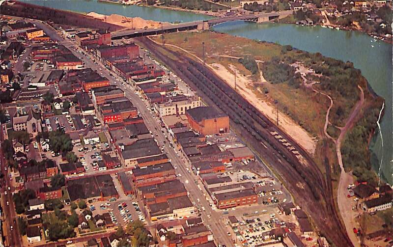
A color postcard showing an aerial view of downtown Lorain and the Black River. The date of the photograph is not certain, but may be from the late 1950s or early 1960s.
Landmarks most prominent in this view include the Baltimore and Ohio/Nickel Plate Railroad tracks and Broadway Avenue. A small portion of the 600 and 700 block of Reid Avenue is visible in the bottom left of the photograph. The Charles Berry Bascule Bridge is visible near the top of the photo at the mouth of Lorain Harbor. Also visible is the First Methodist Church building on Sixth Street to the left of the photo and the Lorain Coast Guard Station on the east side of the Black River (photo center top).
The photographer is not known.
The caption on the back of the postcard (not scanned) :
"Lorain Ohio. Looking north showing the Broadway business section and the Harbor Entrance on the Black River. The Erie Ave. Bascule Bridge spans the river. The Lorain Coast Guard Station and the small boat harbor is in the background."
The publisher of the postcard is Ohio Natural Color Card Co., Columbus, Cleveland, Ohio. It was printed in "Plastichrome (R) by Colourpicture Publishers, Inc. Boston 15, Mass., U.S.A." Photo color is by Howard Studios, Cleveland 15, Ohio.